Maneuvering forces operate in complex, fast-changing environments where coordination and tempo are decisive. Fragmented information and limited visibility slow execution and increase operational risk at the tactical edge.
Mission Planning & Terrain Analysis
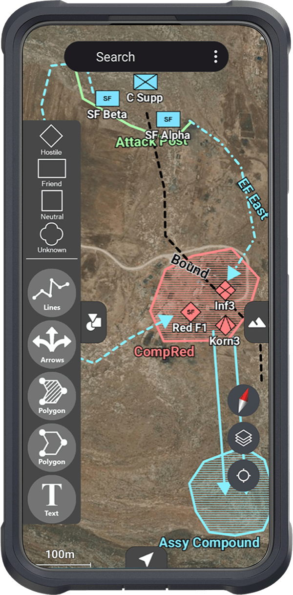
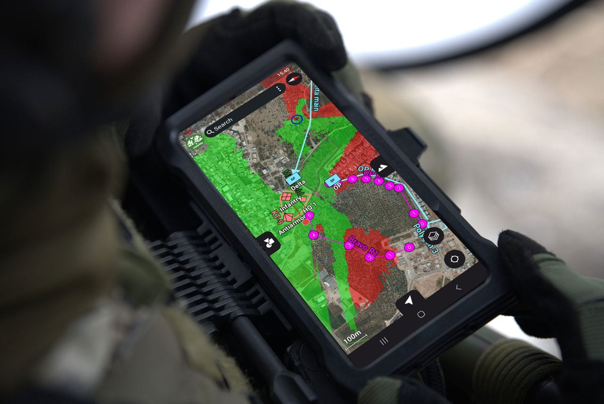
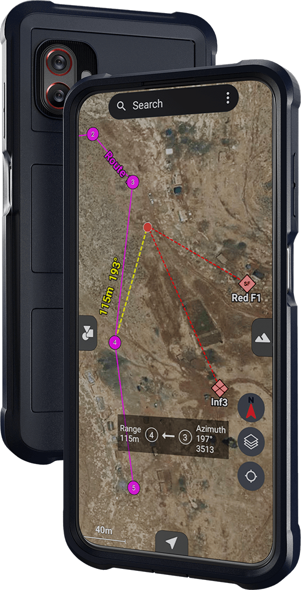
Enables detailed mission planning through terrain analysis, line-of-sight evaluation, navigation route design, and combat position planning before and during execution.
Over-the-Landscape Awareness
Overlays tactical information directly onto the real-world environment to support faster understanding and response in dynamic conditions.
3D Operational Visualization
Provides immersive 3D representations of the operational environment to support deeper terrain insight and informed execution.
Built for Field Use
Delivered on a smartphone-sized Android interface designed for rapid adoption and effective use under operational pressure.
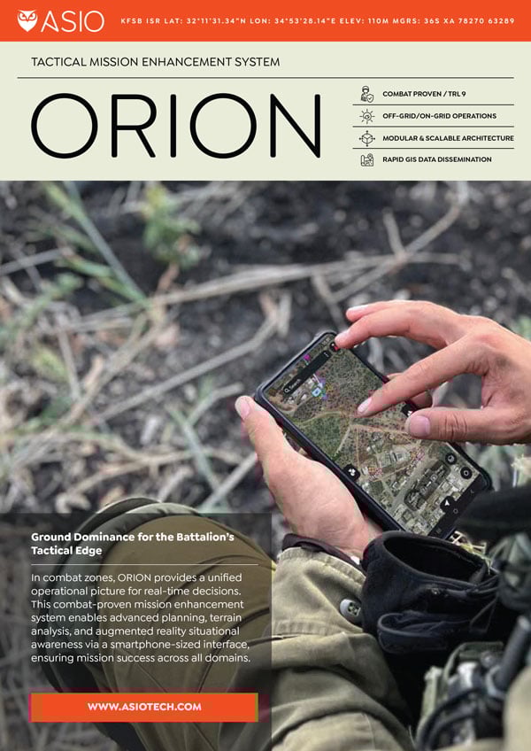
A Unified Tactical Mission Enhancement Hub
ORION extends existing C4I systems to the tactical edge, complementing command and control in contested environments, while serving as a unified hub for advanced capabilities that integrate operational tools into a single, field-ready system.
Operational Deployment With the IDF
ORION is deployed with the Israel Defense Forces under the name Olar, in continuous operational use across tens of thousands of maneuvering force users, from squad level through battalion command.
“For me, the Orion is the second most important weapon, the first is my personal one.”
M, Combat Soldier, Special Forces
Ground Dominance at the Battalion Level
Orion provides tactical insights at planning stages and during battle management, which enhances operational efficiency and mission precision.
Accelerated maneuver and coordination
Improved tempo at the tactical edge
Battalion-level operational advantage in complex environments
Modular and scalable architecture
Rapid GIS data dissemination across units
ORION in Action
Battle-Tested Reliability
Battalion-level operational advantage in complex environments
Threat Analysis
Terrain Analysis
Visibility Analysis
Read More
Articles, comparisons & use cases from the ASIO blog